PLAN-Boulder County sent the following letter to the U.S. Fish and Wildlife Service today (July 28, 2011).

PLAN-Boulder County is an organization of several hundred citizens established more than 50 years ago to advocate responsible environmental stewardship, good planning practices, and good government.
This letter is written in response to the [Fish and Wildlife] Service’s request for public comments as part of the scoping process for the environmental analysis of the proposed disposal of the 300 ft. transportation corridor on the east side of the Rocky Flats National Wildlife Refuge.
We understand that the Fish and Wildlife Service does not plan to include impacts on non-refuge lands in the environmental assessment being prepared pursuant to the NEPA. As you know, Federal agencies are required to include both the direct and indirect impacts of their actions in NEPA documents. By looking at only refuge impacts, the Service would be ignoring this requirement.
Moreover, we note that many of the impacts of the actions being considered were not included in the 2004 EIS, so the current NEPA process cannot rely on that document as an adequate assessment of the possible decisions.
We strongly support the expansion of the Refuge to include Section 16 on the west side of the Refuge, with provision for its acquisition, whichever path is chosen for the transportation corridor on the east side of the Refuge. Because of the wildlife corridors along Woman Creek and the valuable intact native grasslands, preservation of Section 16 is critical to the Service’s successful management of the Refuge.
We request that you reconsider the scope of your analysis to include the impacts on the lands, plant and wildlife habitat, people, and roads in areas outside of the refuge system that will be impacted by the disposal of a transportation corridor to the Jefferson Parkway Public Highway Authority or to the City of Golden. The impacts of a tollway, as proposed by the Authority or of a bikeway, as proposed by Golden, are very different in type and in intensity and therefore the non-refuge impacts from proposed uses of the transportation corridor by the Authority or by Golden must be evaluated, assessed and compared.
We therefore urge you to expand the scope and proposed schedule of your NEPA process to include a comparison of the impacts of use of the transportation corridor on the east side of the Refuge between the proposals of the Authority and of the City of Golden. In particular, the impacts that should be considered include:
- Access for bicyclists and other visitors to the Refuge, as shown in both the 2004 EIS and the 2005 Conservation Plan.
- The degree to which each of the proposals comports with regional alternative transportation plans, such as the Pedestrian and Bicycle Element in the DRCOG 2035 Metro Vision Regional Transportation Plan.
- Impacts on the communities at either end of the two proposals, particularly the City of Golden and the Town of Superior, especially of the construction of the proposed tollway. Both those communities have expressed concern about the effects of the proposed Parkway, so disposition of the transportation corridor by the Service on those communities must be considered.
- Air pollution impacts of projected traffic generated by each of the proposed alternatives.
- Regional growth and traffic congestion that can be projected as a result of each of the proposals.
- Impacts on the flora and fauna inside and outside the Refuge as a result of development on the south side of the Refuge that can be anticipated if the proposed Parkway is built. (Candelas development.)
- Relative impact of the two proposals on Prebles jumping mouse critical habitat outside the Refuge proper.
- Impacts on visitors and wildlife within the Refuge due to traffic noise and air pollution from the proposed Parkway.
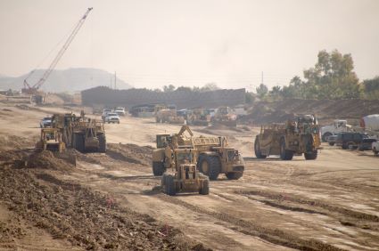
- Hazards from plutonium contamination of the soils on the corridor to be transferred, and the effects that can be expected from construction of either of the alternatives. Particularly, see the map of Pre-Cleanup Plutonium Concentrations at Figure 3 of the 2005 Conservation Plan, which clearly shows the plume of contamination extending east to the transportation corridor. Note that the assumptions in both the Conservation Plan and the 1996 Final Rocky Flats Cleanup Agreement do not consider the effect of major construction disturbance of the soils. On the contrary, the assumption applies to visitors with casual exposure and no significant disturbance of the soil. The use of earthmoving equipment, particularly if the Parkway is constructed, would radically change the exposure of residents of surrounding downwind communities like Superior, Louisville, Broomfield, and Arvada, as well as communities farther east. We contend that any NEPA process considering disposition of this transportation corridor must consider these risks.
We appreciate the opportunity to comment and sincerely request that the scope of your NEPA analysis be enlarged as discussed above.
If Blue Line readers would like to offer comments to the Fish and Wildlife Service, the deadline is Friday July 29, 2011. Please send your comments to:
Mike Dixon
Division of Refuge Planning
U.S. Fish and Wildlife Service
P.O. Box 25486, DFC
Denver, CO 80225
Bruce Hastings, Deputy Refuge Manager
Rocky Mountain Arsenal National Wildlife Refuge
6550 Gateway Road, Bldg 129
Commerce City, CO 80022
email: rockyflatsea@fws.gov


